SEAFLOOR Maps
|
Biota Highlight Movies |
Image Galleries |
This NOAA Ship Okeanos Explorer ROV dive (EX1806-04) was the fourth of 17 successful dives during the 2018 Windows to the Deep expedition (June 2018). These dives investigated the similarities and differences in community composition among deep-water habitats of the Southeast U.S. continental margin. The site, roughly 164 kilometers east of Florida, features isolated mounds unlike others the expedition had seen before.
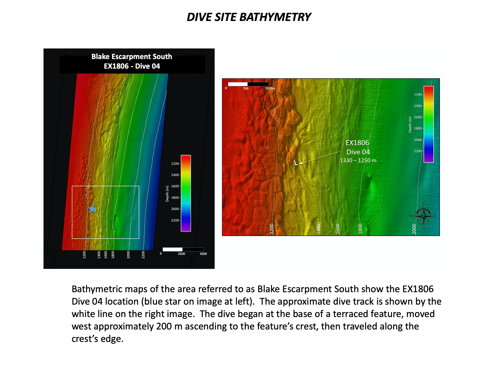
Using the ROV Deep Discoverer (‘D2‘) scientists observed fields of rock rubble with light covering of sediment around 1,310 m below the surface. The slope of the dive site increased as D2 made its way along the dive track. A unique series of terraces were seen during the dive, covering 200 meters of continental slope. A vertical scarp was encountered at the end of the dive, with a broad, flat rocky terrace at its top where several samples were taken.
Numerous organisms were observed during this dive, suggesting this site has ample habitat and food to support a high diversity of organisms. Review the Image Galleries and Biota Highlight Movies, below to examine the many organisms seen along the dive track.
~~~~~~~~~~~~~~~~~~~~~~~~~~~
Watch this overview video of EX1806 Dive 04, condensing a 6-hour dive into 12 minutes of narrated highlights.
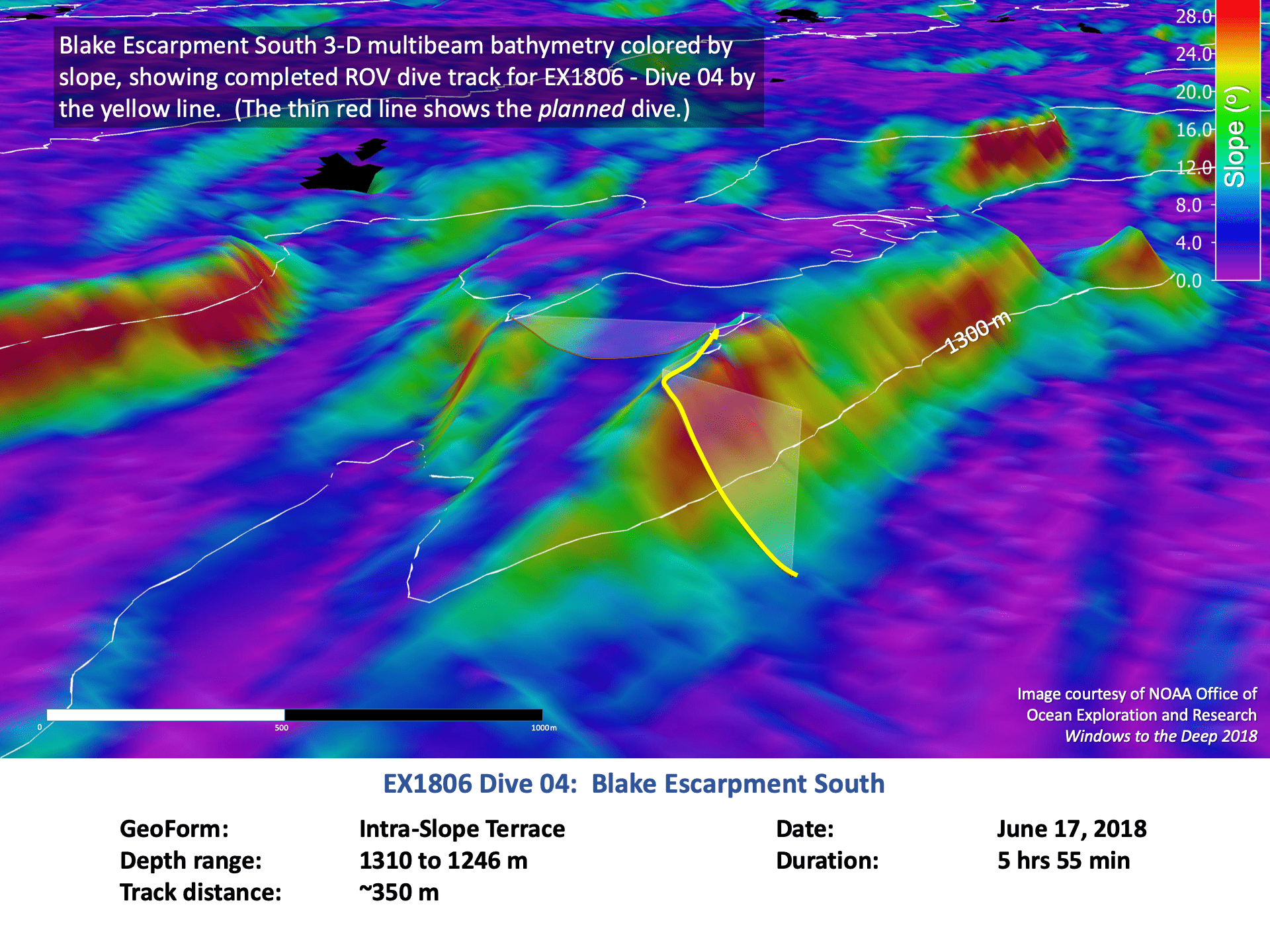
During Dive EX1806-04, ROV Deep Discoverer dove to depths between 1,320 and 1250 m, with the primary objective to characterize the distribution and abundance of benthic megafauna. At the beginning of the dive, the site had a relatively low slope area with several small, low-relief terraces. Further along the dive, exposed rock layers occurred as the slope increased, revealing a nearly vertical rock wall, or scarp at the top. An exceptionally diverse community of sessile megafauna was observed, as well as a few exciting mobile megafauna. To explore further, check out our seafloor maps, biota movies, and image galleries, below.
~~~~~~~~~~~~~~~~~~~~~~~~~~~


SEAFLOOR Maps
|
Biota Highlight Movies |
Image Galleries |
Dive EX1806-04 Seafloor Maps

The white L-shaped line denotes the dive location on this bathymetric map of Blake Escarpment South (made using QPS Qimera).
-
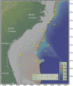
- An overview map showing the locations of all dives for EX1806, with a blue star denoting dive 04 at Blake Escarpment South (Made using GeoMapAPP).

-

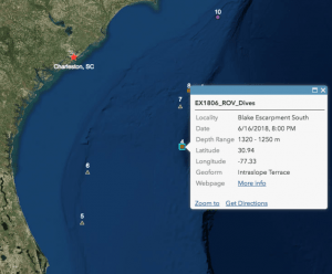
- The blue star denotes the dive location on this map of the bathymetry of Blake Escarpment South (Made using QPS Qimera).
-

- A track of the ROV dive path (yellow line) draped over a 3D bathymetric map colored by slope (Made using QPS Qimera).
-
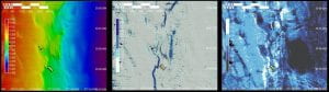
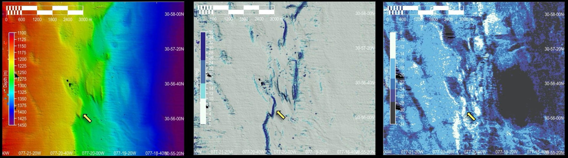
- Bathymetry, Slope and Backscatter Intensity maps, generated using CARIS HIPS & SIPS 11.2 by BEAMS Program student Tanner Maharrey. Yellow arrows show the approximate location of EX1806-Dive 04. These maps show the high intensity returns and high slope of the dive site.
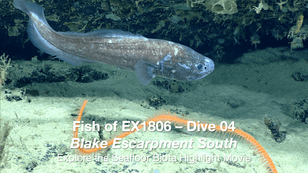
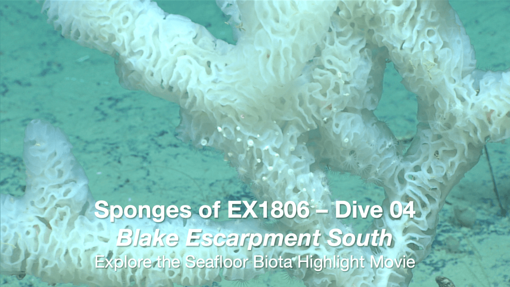
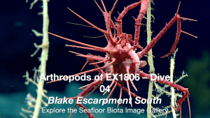
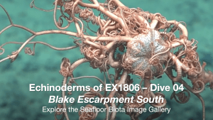
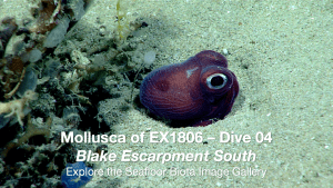
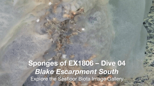
Dive EX1806-04 Biota Highlight Movies
Each movie of a taxonomic group documents the different genera observed during the dive.
 |
 |
 |
 |
 |
 |
Dive EX1806-04 Image Galleries
Image Galleries show the variety of habitats where each of the observed genera were encountered.
An overview of the geomorphology (seafloor characteristics) is also included.
 |
 |
 |
 |
 |
|
 Geomorphologic Overview Geomorphologic Overview |