Blogroll
-
Recent Posts
Categories
- 3D Capture
- 3D visualization
- Academia
- agent based
- Avkat
- classical archaeology
- Conferences
- Courses/Field Schools of Interest
- Geophysics
- geospatial
- Google Earth
- heritage management
- informatics
- Least Cost Paths
- Linear B
- linked data
- Lowcountry field school
- News
- open source
- Projects
- Rome
- RTI
- State of the Field
- Topography
- United Kingdom
- Websites of Interest
- white light scanning
Meta
Tag Archives: Modeling
AquaTerra on GitHub
Newhard, Levine, and Phebus (2014) presented a LCP model that incorporated both terrestrial and marine costs to assist in exploring the connectivity between places. Developed in ArcGIS ModelBuilder, the initial model was streamlined by Nicola Buescher, Christina Carmack, Caleb Whitaker, Zach Campbell … Continue reading
Reflections on the EAA 2013 Roundtable on “Ephemeral Landscapes”
In September, the European Association of Archaeologists (EAA) held its meetings in Pilsen, Czech Republic. I attended this meeting, and participated in a roundtable on ‘Ephemeral Landscapes,’ organized by Martijn vanLeusen, Andrew Bevan, Kayt Armstrong, and Wieke deNeef. The workshop … Continue reading →![]()
Continue reading
Posted in Academia, Conferences, geospatial, heritage management, informatics, State of the Field
Tagged GIS, Modeling
Leave a comment
Three Dimensional Field Recording in Archaeology: An Example from Gabii
Reblogged from The Archaeology of the Mediterranean World: This is the first in a series of posts exploring 3D modeling in Mediterranean and European archaeology. For more on this project click here. We hope these papers will start a discussion either … Continue reading →![]()
Continue reading
Posted in classical archaeology, geospatial, State of the Field
Tagged 3D, Modeling
Comments Off on Three Dimensional Field Recording in Archaeology: An Example from Gabii
Three Dimensional Imaging in Mediterranean Archaeology: A Short Introduction to a Blog Project
Reblogged from The Archaeology of the Mediterranean World: Over the past half decade, Mediterranean and Old World archaeology has entered a bold new world of inexpensive three-dimensional documentation. Using photogrammetry software like Agisoft Photoscan, increasingly powerful laptop computers, low-cost drones … Continue reading →![]()
Continue reading
Posted in geospatial, State of the Field
Tagged 3D, Modeling
Comments Off on Three Dimensional Imaging in Mediterranean Archaeology: A Short Introduction to a Blog Project
Digital Classicist London 2013: Call for Papers
From the Stoa Consortium: Call for Papers January 24th, 2013 by Gabriel Bodard The Digital Classicist London seminar series, which provides a forum for research into the ancient world that employs digital research methods, invites submissions for Summer 2013. We … Continue reading →![]()
Continue reading
Posted in Academia, classical archaeology, Conferences, geospatial, linked data, Topography, United Kingdom
Tagged Classics, GIS, Modeling
Comments Off on Digital Classicist London 2013: Call for Papers
Workshop in Agent Based Modeling at CAA 2013
Preposted from the antiquist… Ever wondered what all this complex systems talk in archaeology is about, or how to design your own sophisticated simulation model? Then this might be for you: We will organise a workshop on complex systems and … Continue reading →![]()
Continue reading
Posted in agent based, Conferences
Tagged GIS, Modeling
Comments Off on Workshop in Agent Based Modeling at CAA 2013
Exploring Ancient and Modern Land Use
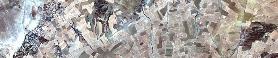
The College of Charleston welcomes Peter Bikoulis from the University of Toronto, in town this week to consult with Jim Newhard and Norm Levine on his work combining multispectral satellite imagery with Ottoman and modern census data to tease out … Continue reading
Posted in Avkat, News, Projects
Tagged Archaeoinformatics, Archaeology, Avkat, GIS, Land Use Classification, Landsat, Modeling, Turkey
Leave a comment
Avkat 3D Update
We are slowly building our facility with SketchuUp, and time for an update. Our Junior Intern has been largely involved with this component, and this post is written by me, but with contributions from Chris. Working with Chris is a … Continue reading
Posted in 3D visualization, Avkat, Projects
Tagged 3D, Archaeology, Avkat, Classics, College of Charleston, Digital Humanities, ESRI, Modeling, Trimble Sketchup, Turkey, visualization
Leave a comment
Junior Internship in Archaeoinformatics
This week, we will be joined by our junior intern in archaeoinformatics. Christopher Newhard will be joining us in the Santee Cooper GIS Lab to check out what his dad does when he’s not cooking him dinner. Far from play … Continue reading
Posted in 3D visualization, Avkat, Projects
Tagged 3D, Archaeology, Avkat, Classics, College of Charleston, Digital Humanities, Modeling, Trimble Sketchup, Turkey, visualization
4 Comments
Modeling Communication Routes Over Land and Sea
In an ongoing effort to announce the initiatives occurring in Archaeoinformatics at the Santee Cooper GIS Lab, work is nearing completion on a project that models least cost paths in environments that require the integration of terrestrial and marine costs. … Continue reading
Posted in Least Cost Paths, Projects
Tagged Aegean Prehistory, Archaeology, College of Charleston, GIS, Least Cost Paths, Modeling
2 Comments